18 April 2011

Amtrak Service and Fares - Routes - # 5 - Short-distance corridors - Eastern

NORTHEAST CORRIDOR  (Washington, D.C. – Philadelphia – New York – Boston)

The northeast part of the U.S. is where the largest single concentration of Amtrak service exists.

The New York-Washington, D.C. market is the only one in the U.S. where more people use the train than fly due to the relatively short distance, the frequency of trains, and higher speed relative to other parts of the U.S.


Between Washington, New York, and Boston, Amtrak offers two distinct services: Northeast Regional and Acela Express.

The former uses older equipment, offers business class and coach accommodations, runs at slower speeds, and makes more stops.  But the Northeast Regional trains are still swift and frequent, and for many leisure travelers the higher cost for a slightly faster ride is not justified.

Acela Express service began in late 2000 using brand-new equipment designed for higher speed service.  The appearance of the trains is similar to that of some European high-speed trains.  Classes of service include business class and first class, and among other features, these trains offer "Quiet Cars" (cars where use of cell-phones, loud conversations, and other noisy nuisances are not allowed) as well as free wi-fi.

These trains reach 150 mph (240 kph) on a stretch of track between New York and Boston, but mostly run at lower speeds than that.  Wikipedia has an excellent page about Acela Express.

Acela Express is Amtrak’s flagship operation in the Northeast and gives a taste of what would be possible if the United States ever got off its rear end and caught up with the rest of the developed world, not to mention Taiwan, China, and South Korea.  Fat chance, considering the dreary politics of "no taxes"/disinvestment that mark this era.

Why anyone would fly between New York and Washington astounds me when the service by train is so much more pleasant, and overall door-to-door travel time usually faster by train than by air.

Some of the Northeast Regional trains operate south beyond Washington, D.C. as far as Richmond, Newport News, and Lynchburg, Virginia.


KEYSTONE (New York-Philadelphia-Harrisburg)

Keystone service connects Harrisburg, the capital of Pennsylvania with Philadelphia, and points north as far as New York.  Only coach service is offered, without any other amenities such as meal or beverage service.


Between Harrisburg and Pennsylvania the service is unreserved like a commuter train. 
Between Harrisburg and points beyond Philadelphia seats are reserved, but not preassigned.  Trains operate all day long.


DOWNEASTER  (Boston-Portland, Me.)

This service links Boston (North Station) to Maine as far north as Portland, with Amtrak Thruway motorcoach (bus) extending the reach of the service as far as Bangor.  (Northeast Corridor service in Boston to New York operates out of South Station.)  Business class and coach service is provided.  5 trains operate each direction.

Because Downeaster service leaves from Boston North Station and all other Amtrak service operates from South Station, you're best off using a taxi to get between the two stations (instead of transit) if you have much luggage.


CAROLINIAN / PIEDMONT  (Charlotte-Raleigh-New York)
 
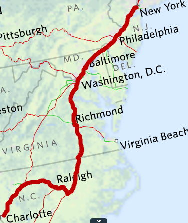
Amtrak operates Piedmont service within North Carolina between Charlotte and Raleigh twice daily.  Coach service only available.

Once daily Carolinian trains operate between Charlotte, Raleigh, and New York.  Business class and coach service is provided.


PALMETTO  (Savannah-Charleston-New York)

It makes for a very long day, but Amtrak operates a non-overnight service between Savannah, Charleston, and New York on the Palmetto.  Business class and coach service is available.


ADIRONDACK (New York-Albany-Montréal)

The Adirondack operates daily between New York and Montréal along the Hudson River and Lake Champlaign.  Reserved coach service is available, and snack service in a café car.  In years gone by Amtrak's sole remaining dome car has been used on the train during the autumn.


ETHAN ALLEN EXPRESS (New York - Albany - Rutland, Vt.)

This daytime train follows the same route as the Adirondack as far as Whitehall, N.Y., where it turns east to terminate at Rutland, Vt.  Coach and business class service is offered.


VERMONTER (New York-Montpelier-St. Albans, Vt.)

The Vermonter runs through Connecticut and western Massachusetts to the capital of Vermont (Montpelier) and ends in St. Albans, close to the Canadian border.  Service choices on board the Vermonter include coach and business class.

While this is a daytime train, its predecessor along the same route was the Montrealer, an overnight train I took twice in the 90s as far as Montpelier. 


EMPIRE SERVICE (New York-Albany-Syracuse-Rochester-Buffalo-Niagara Falls)
MAPLE LEAF (New York-Toronto)

Empire Service (as in the "Empire State") is offered from New York City to Albany and beyond to upstate New York as far as Buffalo and Niagara Falls.

Currently twelve daily trains operate as far as Albany (including the Adirondack that continues to Montreal), and three of those trains continue as far as Buffalo and Niagara Falls.  Except for the Adirondack, the trains all offer both coach and business class service.

The Maple Leaf is one of the three trains to Niagara Falls, N.Y., but it continues on to cross the Canadian border and terminate in Toronto, Ontario.  It is one of three Amtrak trains that operate internationally, the others being the Adirondack and the trains in the Pacific Northwest that serve Vancouver, B.C.  Unlike these other two services where Amtrak personnel work all the way through to Canada, on the Maple Leaf the Amtrak crew is replaced at the Canadian border by employees of VIA Rail Canada, and vice-versa when operating from Toronto to New York. 


Amtrak Service and Fares - navigational links
Backward to Routes - Long-distance trains - Eastern (Chicago to the east coast)
Forward to Routes - # 6 - Short-distance corridors - Central
Introduction

14 April 2011

Car rental - Outta Arizona for $5 a day

In my business, I also confirm car rentals for clients in addition to their hotel reservations.  Because I mostly book Hertz, I try to keep an eye on their special deals.

I ran across a seasonal doozie that could make for an interesting trip.

Arizona is a popular winter destination so it's logical that by the end of the season Hertz would have more cars on hand than they would need for the low demand summer.

What is the answer to their problem?  Offer ludicrously low rates for customers who drive the vehicles one-way out-of-state.

The result for you is rates as low as $5 per day if you take your rental car somewhere and almost anywhere outside of the state.

You can return the car to Hertz locations - both at airports and elsewhere - in California, Oregon, Washington, Nevada, Utah, Colorado, New Mexico, Oklahoma, and Texas.  And you can keep the car for up to 14 days, and still only pay the $5 (or higher) rate per day plus tax.  The last day you can pick up the car and enjoy this price is 31 May 2011.

You may pick up the cars at any Hertz location in Arizona.  Not just the Phoenix airport, but Tucson, Flagstaff, Yuma, or any of what are called "Hertz Local Edition" locations in downtowns, hotels, and suburbs.

OK, you don't live in Arizona, so how could this work for you?

Be imaginative.  Here are two examples.  (Read my Airline Fare School chapter about "Open Jaws and Tinkertoys" if mixing modes of travel is not something you're comfortable with.)

Example 1.  You live in San Francisco.  Fly to Phoenix, pick up the car, drive to Las Vegas, then go through Death Valley to Bishop in the Owens Valley.  Then head north to Lake Tahoe, then head home and drop off the car at the Mason Street Hertz location in San Francisco.  5 days economy or compact car rental: $75.92 with tax.  (If you picked up the car at an off-airport location in Phoenix it could be as low as $35, or even lower with AAA or other discounts.)

Example two.  You live in Chicago.  You fly to Flagstaff.  A day after you arrive you pick up a compact car at the Amtrak station and then make a ten day trip through California and Oregon and return the car at the Portland airport.  The 10 day car rental comes to a whopping $63.70 with tax.  (Prices for the same rental for an intermediate size car would be $213.60, standard size car $226.12, full size $238.61.  In certain locations some convertibles and SUVs can also be rented under this deal.)

Read the deal's fine print here.  A very similar offer is available for one-way rentals out of Florida.

12 April 2011

Running - Mt. Ashland Hill Climb registration opens 15 April

In August 2010, I ran a very tough all-uphill (5600' elevation gain) half-marathon called the Mt. Ashland Hill Climb Run and wrote about it in my blog.  This year the event takes place, as is customary, on the first Saturday in August, specifically 6 August 2011.


YOU WILL GET YOURSELF FROM HERE TO THE SUMMIT

The organizers announced that on-line registration will commence on Friday, 15 April.  This is a small, popular event with a hard-core group of annual participants.  It will sell out.  Though the U.S. Forest Service has given permission to add 50 more runners, that means the number is still capped at around 300 - hardly a large number.

I'll be there to try to break the three hours that I narrowly missed in 2010.

If you run the Hill Climb be sure to book your hotel room soon, since summer weekends in Ashland book up not because of this race but because of the Oregon Shakespeare Festival theatre-goers.  Ashland makes a great destination with a near perfect combination of scenery, outdoor fitness opportunities, culture, eating, and drinking, including two breweries, one of which, Standing Stone, is a race sponsor with a keg at the end for thirsty runners.

(Note added 18 May - On the event website it said that the Hill Climb registration sold out in two weeks. If you missed out but want to run this in 2012 you should sign up for an email notification and act quickly next year.)

04 April 2011

Running - Oakland Marathon 2011

For those of you acquainted with my blog, you may have read all or some of my 21-part "Oakland Marathon neighborhood tour" series.  Last Sunday, 27 March 2011, was the day that my running shoes replaced the keyboard as I took the 26.2 mile tour with about 900 new friends.  While the race is still fresh in my mind, I'll offer an account.

If you want to follow along with a course map, here's a link you might wish to open in another browser tab.

My race bib, post-race


In spite of the stormy weather from the preceding week, conditions on race day were excellent for running: 

Cool and cloudy, with periodic sunbreaks.  I felt the tiniest of sprinkles twice while running, and that was all.  The weather gods clearly looked kindly on the second annual Oakland Marathon.

After a nice rendition of the national anthem and a send-off from new Oakland mayor Jean Quan, we had an on-time departure at 7:30 a.m. from the center of Oakland's downtown on Broadway at 14th Street.  (Half marathoners would start later at 9:00 a.m.)

Except at the very start, the spectators were not out in force for the earliest part of the race running north on Broadway through Uptown and Auto Row. then veering to the right up Piedmont Avenue.  At the corner of 41st and Piedmont Avenue, the race made a left turn past the first aid station, which was staffed by my old running club, the East Bay Front Runners.  This was the first larger showing of spectators.

The course crossed Broadway and at Telegraph made a right turn into the Temescal neighborhood.  Folks were here to welcome us, including a woman with a home made "Welcome to Temescal" sign, and a professionally made banner that hung above the street.  For all I know, similar banners hung over the streets in other neighborhoods but my running swacked brain missed them.  If not, it would be nice touch for each neighborhood to concoct its own "Welcome to Such-and-Such Neighborhood" for the marathon.  Could be a friendly neighboorhood contest that the runners vote on after the race.

It was in Temescal that I began yelling "Good Morning, Temescal" as I passed through a neighborhood, or "Go, Oakland".  I was getting my Oakland groove on.

As we turned right on 51st and went past the Oakland Fire Department station there, I would see the first of many of OFD firefighters cheering on runners along the course.  Nice touch, Oakland!  I also noticed that they had their equipment parked outside the station, perhaps that was so they could respond to calls if necessary without breaking through the line of runners.

At Broadway we turned left, went only one block, and then veered left on to the start of College Avenue and the beginning of the Rockridge District.  It was still pretty early and there weren't too many people out watching, but more appeared around the BART station and at the course's U-turn at intersection of College and Claremont.

Back under the Rockridge BART station, and then a left turn on Keith Street and back on Broadway took us to Lake Temescal and the biggest crowd thus far, amplified by the fact that it was the first exchange point for runners in the marathon relay.  (182 4-person relay teams ran the marathon.)

Though there had been an overall elevation gain since the race start, and some slight ups and downs, the significant elevation gain began upon leaving Rockridge headed to Lake Temescal, and then from there into Montclair.  The event's elevation profile shows that from the start at about 90' above sea level the highest point of perhaps 650' is reached twice between miles 8 and 10.  Though it is not continuously uphill from Lake Temescal to Montclair and the Mormon Temple area, it is mostly so.

Compared to CIM (California International Marathon) and the Eugene Marathon, the two other marathons I've run in my "modern" marathon era (starting in 2009), the Oakland Marathon course is more challenging, but happily the hills get worked out early on, resulting in a basically flat race from mile 13 onward.

The course meandered through quiet residential streets of Montclair with occasional onlookers until it hit Montclair's "Main Street" (Mountain Avenue) which had lots of spectators as well as a temporary downhill relief.

Crossing above Hwy. 13, the race continued downhill crossing Park Street, then resumed the uphill slog along Monterey Blvd. with periodic spectators until shortly before a zig-zag on back streets that led to Lincoln Avenue.  During that zig-zag the uphill ended, and the downhill began at the end of mile 10 with a sharp right turn on Lincoln Avenue by the Mormon Temple and a big crowd of cheering folks.

It was so steep here that at first I had to catch myself from losing control, but ultimately I opted to exploit gravity.  I'd deposited the money in the bank, and now it was time to withdraw it.

Mile 11 is all steep downhill as it shoots down to the Dimond District. The course skirts Dimond's "downtown" just to the east.  Where Lincoln passes under I-580 was another huge crowd of cheering folks, made large again because it was the second relay exchange point.

The course continues downhill (but not as steeply as before) along Coolidge Avenue and the Peralta Hacienda Historical Park with a left turn on Foothill in a neighborhood business district.  Crowds were sparse but friendly along Coolidge and Foothill.  (Coolidge is a quiet residential street, while Foothill is an arterial.)

After about a half mile along Foothill another right turn resulted in a short distance on 42nd Street, followed by another right turn on International Blvd. where the longest straight stretch (roughly 2 miles) of the marathon began in the heart of the Fruitvale area.  Crowds were not large here, but enthusiastic.

At 14th Avenue the course made a left, then a block later a right on 8th Street.  Not long after the switch to Eighth Street I remember a very friendly crew handing out Gummi Bears around mile 16.

Now by this time in a marathon with about 900 finishers, runners were strung out with pretty large gaps in between individuals or twosomes and threesomes.  That was about to change at roughly mile 16 1/2.  Shortly before we reached Laney College, the courses of the marathon and half-marathon converged.  Marathoners about 2 hours into the race, and half-marathoners about a half hour (and 3.25 miles) into their race would now be running together to the finish line.

Of course, I'd looked at the course map before the race so I knew this was going to happen but it still came as a surprise when it did.  At first it was a little disconcerting.  Streets that pretty much had belonged to me, I suddenly had to share with many more half-marathoners.  (3400 runners finished the half-marathon.)

But I got used to it quickly, and in fact the addition of so many other runners added to the energy of the event.  An Asian drumming band by Laney College didn't hurt either.  The other interesting thing was that the half marathoners I was now in the midst of were all slower than I was, so there was the added bonus of continuously passing many people.

I think at this point I understood why we were given a little bib that read "Full" to put on our backs.  In addition to our race number bib that we wore in front, all of the full marathon runners were given a little bib with the word "Full" on it to pin on our backs.  Once we were streamed together with the half-marathoners the "full" bib made it easy to tell who our competitors were, and it also alerted half-marathoners to move over, if they were so inclined.  (Several times I heard half-marathoners yell "full marathoners coming through".)

So except for a few times when I had to work to get past a knot of slower runners, all in all I liked the streaming together of full and half-marathoners.

The course at this point nicked Chinatown, then passed along Second Street in the Jack London Square area, then zig-zagged to run along 7th Street into West Oakland.

Near the corner of 7th and Mandela Parkway was one of the high energy points in the race.  Crowds were large as it was the third and last of the relay exchange points, but it was also the location for a cool band, and the Crucible's fire arch underneath which runners passed.  (No, we didn't burn up!)

It was a good place for high energy as this marked the end of 19 miles.

The next mile was north along Mandela Parkway through West Oakland.  I liked the residents who greeted us with "You are in Oakland West!".  Plenty of high-5s here.

At about mile 20.25 the race turned right on 32nd Street, and began an eastward street-jumping course mostly along 28th and then 27th Streets that would lead us ultimately to Lake Merritt and the final three miles of the race.  At an aid station and at another location along this part of the race there were lots of spectators to cheer us on.  At mile 21 I could definitely feel my energy start to flag, but it wasn't any kind of bonk.  I knew I was capable of another 5 miles, and was happy that there wasn't more than that.

We crossed Grand Avenue at Harrison and then took to the pedestrian path that runs along an arm of the lake, past the bandstand, and through Lakeside Park in the Adams Point neighborhood and then ended up back on Grand Avenue.

(This is the only part of the course I would change.  I think the inaugural race last year ran on 27th Street past Whole Foods to Grand, then along Bellevue Street in Lakeside Park back to Grand, which is preferable.  The pedestrian paths we trod were too narrow, too rutted, and too muddy for runners who are tired after 10 or 23 miles of running.)

After a short stretch on Grand, we made a right turn just before 580 and the Lakeshore neighborhood, and then made another right on Lakeshore Avenue.  We were now 24 miles into the race.  At a point when we really needed it, we were able to enjoy great scenery and easy street running along Lake Merritt.  The views of the lake and our destination in downtown Oakland were stunning.

By now, the runners were again no longer clumped together and the street was nice and wide.  We ran down the east side of the lake, along the under-reconstruction 12th Street viaduct, and then past the Lake Chalet and the Essex condominium and the 25 mile point.

One-point-two-miles left to go to the finish line.

After the curve on Lakeside past the Essex we veered west onto 19th Street and up a slight slope past Snow Park where the Kaiser volunteers were cheering for us and operating another little aid station.  Three blocks later we crossed Broadway (only 5 blocks from where our race began) and went one more short block to face the Fox Theater art deco extravaganza on Telegraph where we made a sharp left turn to the south.

I'm at the home stretch here


Finish line ahead!


At this point you can start getting nostalgic for the race that is nearly over, because two blocks on Telegraph to Broadway, another block on Broadway and a right turn on 14th and there was the finish line.  At Broadway all of the way to the finish the crowds were lined up against the barricades.  The cheering would have brought you in even if you didn't think your legs would.

Marathon # 11 was done, and I'm so happy I ran it in Oakland.  It makes a terrific setting for a marathon.

Finish time was 3:32:52 (per mile pace: 8:08 / per km 5.02).  Not one of my fastest but my training period was shortened due to an injury, so I put the miles in and ignored the speedwork and beat the modest goal I had going into it.  Next marathon on my calendar: CIM 2011 (4 December).

After a shower at the hotel, I joined my cheering section at Pacific Coast Brewing Co. for a couple of Pliny the Elder IPAs and a reuben sandwich.  Decadent?  You bet.  Sorry?  Not hardly.


Oakland Running Festival 2011 program


The course was excellent, more aid stations than you knew what to do with, lots of Oakland Police Department and volunteers keeping the traffic at bay, and plenty of community support for an event that is only two years old.

Corrigan Sports has just gotten started with this.  In their capable hands, and with the support of the City of Oakland, the business community, and the city's neighborhoods, I think the future for the Oakland Marathon is bright.


For your further Oakland Marathon reading pleasure:
- Oakland Marathon neighborhood tour
- Excellent race report by a fast guy (2:53:49), Scott Dunlap, with lots of pics, too
- Oakland Tribune article about the event's economic impact on Oakland
- Oakland Marathon / Oakland Running Festival website
- Race results